OceanGrafix — Accurate Charts. Confident Boating.
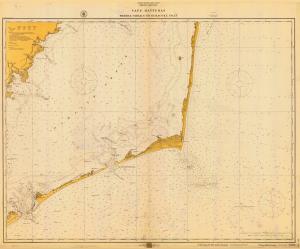
Chart 1232-04-1916
NC,1916,Cape Hatteras-Wimble Shoals to Ocracoke Inlet
Scale:
Paper Size: 20.0" x 24.0"
The chart you are viewing is a historical chart from OceanGrafix. Because it depicts historical information, it is not intended for navigational purposes. This chart is available for purchase online or from one of our retailers.
Buy Online chart 1232-04-1916 - NC,1916,Cape Hatteras-Wimble Shoals to Ocracoke Inlet
