OceanGrafix — Accurate Charts. Confident Boating.
NOAA Bathymetric Charts by OceanGrafix
The topography under the water
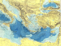 Bathymetric charts by OceanGrafix provide the submerged equivalent of above-water topographic maps. They are designed to present an accurate, measurable description and visual presentation of the submerged terrain.