OceanGrafix — Accurate Charts. Confident Boating.
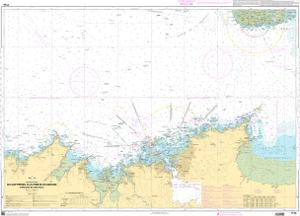
SHOM Nautical Chart SHOM7155
Du Cap Fréhel à la Pointe du Grouin - Approches de Saint-Malo
Scale: 48800
Paper Size: 36.0" x 48.0"
Actual Chart Size: 44.6" x 32.1"
Edition Year: 2017
Corrected Date: 2025-07-15
France's Naval Hydrographic and Oceanographic Service charts provide commercial and recreational mariners with navigational information.
Buy Online chart SHOM7155 - Du Cap Fréhel à la Pointe du Grouin - Approches de Saint-Malo
