OceanGrafix — Accurate Charts. Confident Boating.
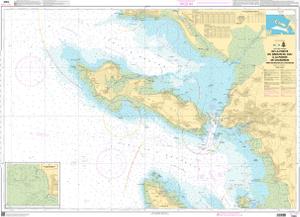
SHOM Nautical Chart SHOM7404
De la Pointe du Grouin du Cou à la Pointe de Chassiron - Pertuis Breton et dAntioche
Scale: 50000
Paper Size: 36.0" x 48.0"
Actual Chart Size: 44.5" x 32.2"
Edition Year: 2024
Corrected Date: 2025-11-04
France's Naval Hydrographic and Oceanographic Service charts provide commercial and recreational mariners with navigational information.
